10K and FunRun Course Detail 2023
• 10k course map
The 2023 route reverts to follow Frederick Street (as in 2019) there are still some Town centre improvement works underway but we
have checked and can safely use that route.The Traffic Management plan seeks to provide access where it can safely do so,
(in Canklow and the areas around Middle Lane south to have vehicle access and egress) and we have also had to liaise with the
construction for the installation of the cycle lanes in Broom Road. Checks will take place the week before the event date, to ensure
the race can safely pass through the construction works.
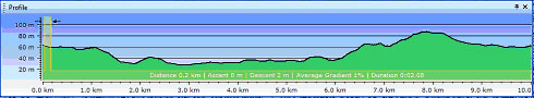
• Profile and description
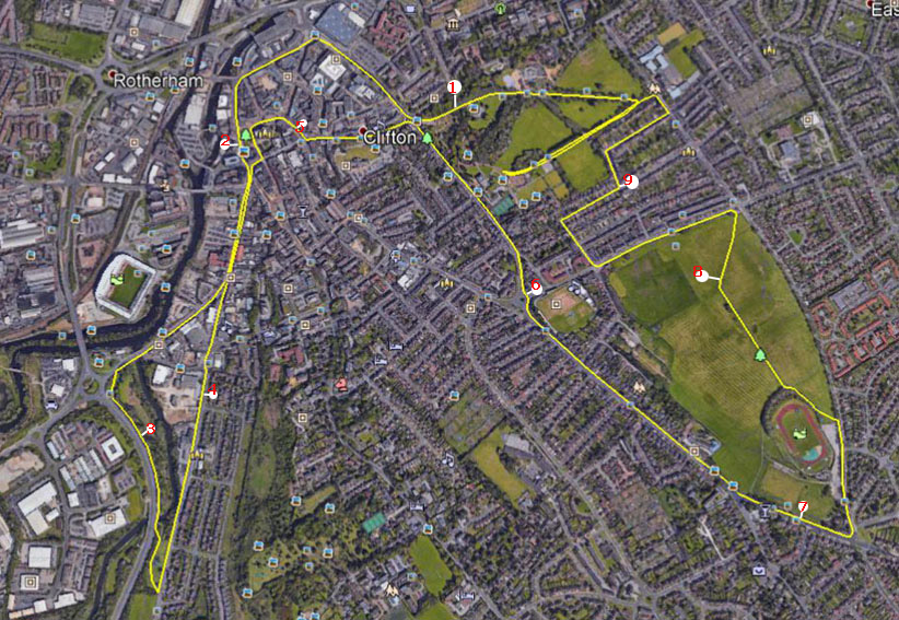 The marked route in yellow is 10,000m long, the event is licenced by UK Athletics and certified & measured
The start will be on the park paths behind the museum cafe, run along towards Clfton Lane turning 150 degrees left to descend to the roundabout near the wet play area then run along past the bandstand entrance to exit via the war memorial gates.
Out of the park the route goes diagonally across the junction to descend Wharncliffe Street, then Drummond St towards the Tesco supermarket, turning left onto Effingham Square, then Frederick Street. (This left turn onto Effingham Square turn allows vehicle access Tesco from Centenary Way).
• 10k course
After Frederick Street the route goes out on Corporation St, then Market Place & out along Westgate, then left on the footpath alongside
Centenary way, turning left on the path to cross through Canklow recreation ground & out into Canklow road to return to Westgate.
The return route (both outgoing and returning runners will run on the RHS of westgate), with returning runners turning right into Market
Street, then left onto Church Street, passing the Minster to enter the pedestrianised area on Bridgegate then All Saints Square (the likely
location of the water drinks station).
Then College Street to exit and turn left to climb Doncaster Gate, turning right into Clifton lane, to pass
the park entrance at about 6.5Km, then on Broom Road then Wickersley Road to turn left onto Middle lane South, passing the stadium and then
turning left to follow the paths across Herringthorpe Playing Fields
Emerging near the Park Hotel to turn left on Badsley Moor Lane, then via Badsley
Street, Lister Street, Middleton Road & Clifton Grove to re-enter the Park opposite Clifton School. The last 400m or so are on the park paths to finish
outside the Garden house near the museum.
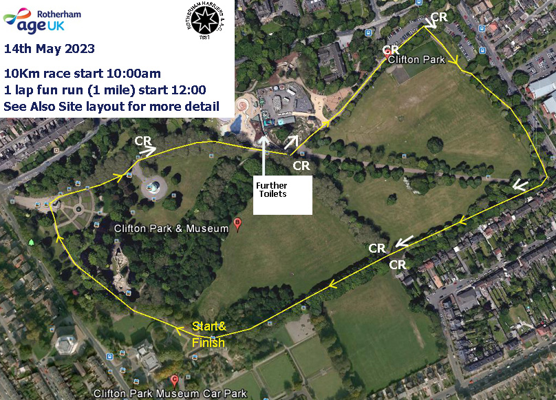
• Fun run course
This will be in the grounds of Clifton Park. The fun run will not leave the park but will use peripheral paths in the park to make up a route of 1 mile. A Fun Run map is shown below.
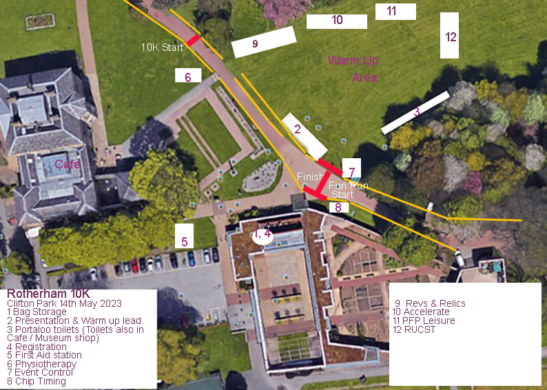
 The start / Finish area and layout of the event area of the park is below.